The Lubahn Trail on STM, Ignored But Not Forgotten
Hello from Miss Mountain Manners!
 Today we have a little history lesson plus a talk about proper trail etiquette. I want to show you what happens when visitors to the parks fail to #StayOnTrail.
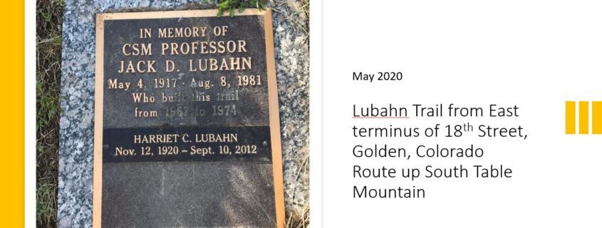
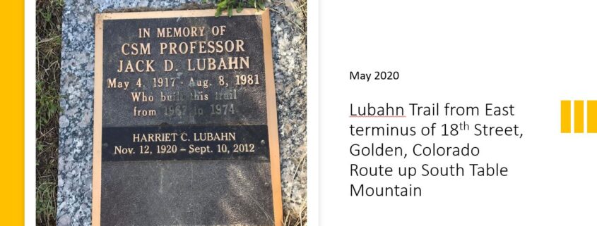
Rarely do we post about parks or trails that are not part of Open Space, but this trail deserves special attention. The Jack D. Lubahn Trail, a trail that belongs to the City of Golden, snakes up South Table Mountain from the eastern terminus of 18th Street in Golden.
The Lubahn Trail has a long history. It was begun by Jack Lubahn in 1965, shortly after he and his family moved into a house at the corner of 19th Street and Table Drive. This was a labor of love; each morning Jack would work on trail building for an hour before heading to his day job at the School of Mines.
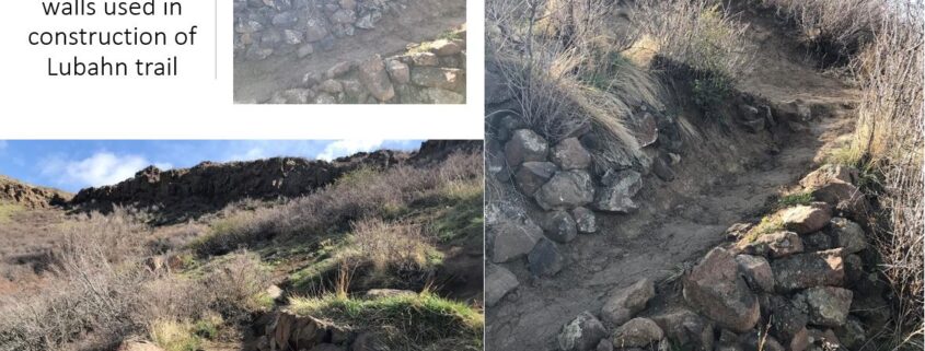
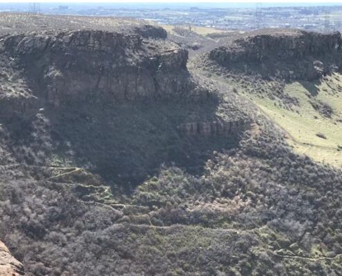 The trail took six years to finish; it was completed in 1971. To build the switchbacks, Jack had to move boulders that weighed up to two tons with just his block and tackle – truly a labor of love! The rock retaining walls on the trail stand as a tribute to his efforts.
https://stewardsofgolden.org/lubahn-trail%2Fsouth-table
The trail tracks through land that belongs to the City of Golden. In 1995 and 1996 Jeffco Open Space paid 70% of the cost of 7.5 acres on the western slope of South Table Mountain, which the County then deeded back to the City of Golden with a reverter clause – typical of JCOS investments that partner with a city or rec district. The reverter clause ensures that the land will be used for recreation; otherwise, the property will revert back to Open Space.
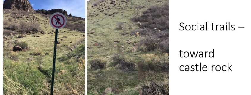
 According to Colorado Lifestyle: “No one ever hikes the Lubahn Trail by itself. Instead they use it as the primary way to get part way up South Table Mountain in Golden and then use one of the many unofficial (social) trails to the top of Castle Rock (formally known as Table Rock). According to the city, this additional excursion is illegal because it traverses private property.”
http://colorado-lifestyle.blogspot.com/2009/05/lubahn-trail.html
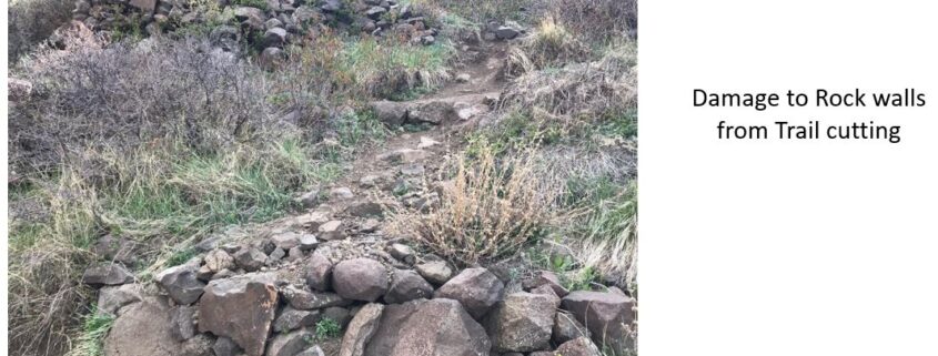 These photos show what can (and does) happen to a trail when it’s abused. Over its lifetime, trekkers and hill climbers, on foot and mountain bike, have short-cut the switchbacks, causing damage – in some places, significant damage – to the original rock work that forms the walls that line the trail. As a knowledgeable Park Visitor, I’m sure you would never do something like this, because if you did, then you would be adding to the damage on the trail.
Hiking the Lubahn can be challenging. The base of the trail is 5676 feet in elevation. By the time you get to the top of the official trail, you’ve gained 400 feet, and if you persist in trespassing and climb to the top of the castle rock (a total of 643 feet from base to top of the castle rock), you’ll encounter multiple social trails and the crumbing Lubahn itself. But, Dear Visitor, I’m sure you would never knowingly trespass on private land.
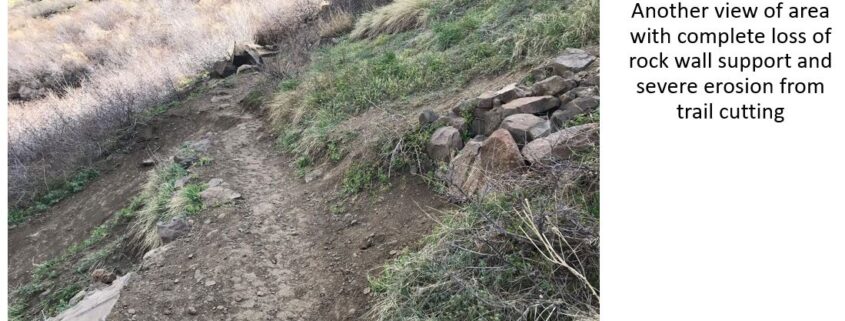 As you can see from these photos, the Lubahn Trail can be narrow in parts. Social distancing in this age of Covid is not possible when encountering others coming in the opposite direction, so have your mask ready and put it on.
Note: stepping off the trail is not a good idea, since South Table is known rattlesnake territory. Even though a rattlesnake cannot lunge much beyond 1/2 to 1/3 of its length, an encounter with a rattlesnake that results in a bite is not something that you want to experience.
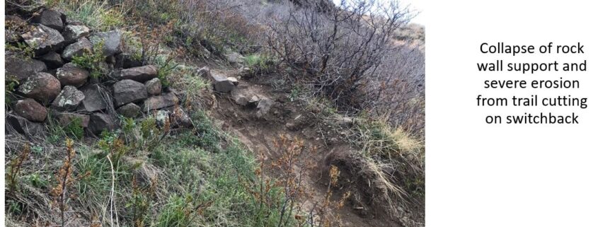
The Lubahn trail emerges on top of the mesa on private land; it’s the most obvious route up to the castle rock, which is where most visitors want to go. The castle rock itself is on private land. Continued and ongoing short-cutting, perhaps because of the steepness of the grade, has continued to tear up the trail, causing loss of the rock walls’ integrity and serious erosion of the slope.
 There is no clear boundary between the private and JCOS land, although there are some recently installed posts on the JCOS border along the new JCOS trail, saying that it is private land behind the posts. None of these posts are visible from where one attains the mesa top via the Lubahn trail, and no one taking the Lubahn would have any way of knowing they were on private land. It’s also not clear where the border is between city of Golden and private land.
Today there are two trailheads within 1/2 block of each other, on a neighborhood street, both very visible. The Lubahn trail has a sign and a trashcan at the entrance plus an information board on local geology. The plaque in the top photo is a short distance up the trail.
 A half-block away is the new JCOS trail. It has a COVID signboard plus a newly installed map of South Table Mountain open space. There is no official parking or public restrooms. The neighborhood street is almost always packed with parked cars. Any park visitor would assume both trails are sanctioned for use. A very common hike is to go up one trail and come down the other.
The new trail construction on South Table Mountain is beautiful. Many people are excited about it. The field patroller who provided the information for this article has talked to many visitors who are really excited about the new trail, and two equestrians who were making their way up to the mesa top – something that was not previously possible for a horse.
The Lubahn trail has done well for being over 50 years old and not having had a dedicated maintenance program. Mike Foster, JCOS Stewardship Manager, has been in conversation with Golden about building an alternate to the Lubahn that would require less rock work and would integrate more closely with the contours of the land. At this time it’s not clear what will happen to the Lubahn.
Many thanks to our PLAN Jeffco Board Member and JCOS Field Patroller Lydia Andrews-Jones for providing these captioned photos on the historic Lubahn Trail. So remember, Dear Visitor, when you’re hiking South Table, Lydia will be watching and welcoming, and can tell you the story of the Lubahn trail.
 Like us at www.facebook.com/PLANJeffco Follow us @PLANJeffco and @MountainManners

